Four school districts close, but storm’s impact less than feared
By Mike McGann, Editor, The Times
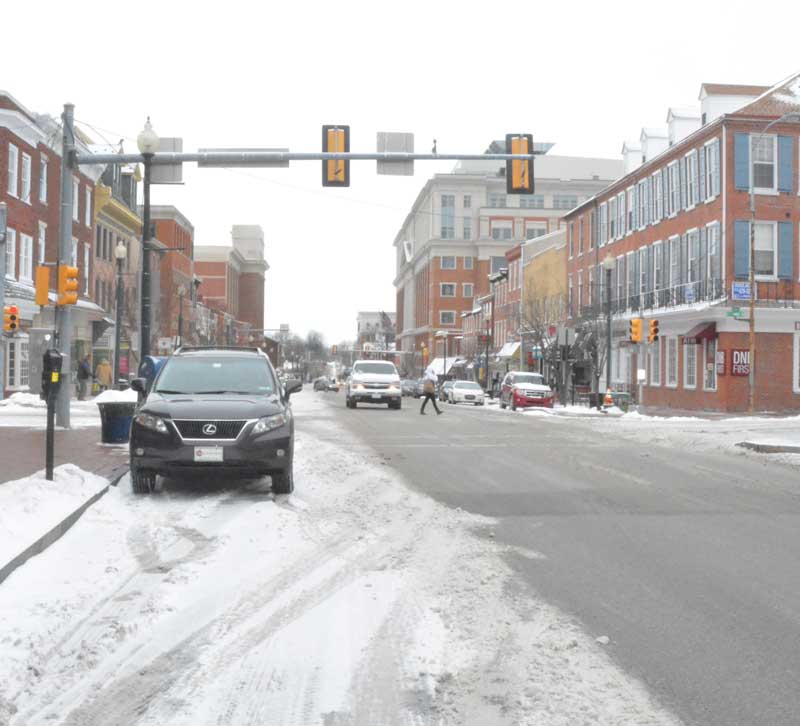
Market Street in West Chester was largely clear by mid-morning Monday, but many sidestreets — particularly in the southern part of the county has slippery patches — as the turned out be less severe than originally forecast.
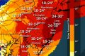
Chester County appears to have been spared the worst of a late-winter storm — which hammered the nation’s capital, but appears to have dropped only a few inches of snow, with the highest accumulations in the southern portion of the county.
Despite the early forecasts of a major snow event, the bulk of the heavy snowfall happened to the south of the area, with Washington, D.C., Richmond, Va. and Baltimore getting hit hard.
Most of the snow had stopped across the county around noon, but a small line of snow showers was expected in the early afternoon, but no appreciable accumulation was expected.
Four school districts, Unionville-Chadds Ford, Kennett Consolidated, Oxford and Octorara closed school Monday, with the rest running on delayed opening schedules. Chester County offices opened on a two-hour delay.
While most county roads were passable by midday Monday, there were a number of icy spots — and authorities reported a handful of accidents. Icy conditions will be a concern throughout tonight as the area undergoes a deep freeze, with the overnight temperatures expected to hover around zero, according to the National Weather Service.
Most municipal snow emergencies expired by noon.
As of midday Monday, PECO was reporting no power outages in the county.
On the positive note, the NWS expects moderating weather after tonight’s deep freeze, although there is a chance of wintry mix next Sunday. More signs of spring: Daylight Savings Time starts early Sunday (Spring Ahead!) and Spring, or the Vernal Equinox, is at 12:57 p.m. EDT, March 20.